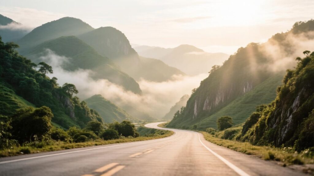
Conquering the ultimate mountain highway circuit in Southeast Asia requires a specialized level of operational stamina, mechanical confidence, and route planning. For overland adventurers establishing their primary base in the northern capital, selecting a reliable machine from an elite motorbike rental in Chiang Mai agency is the vital catalyst for safely managing multi-day alpine expeditions. The Mae Hong Son Loop, cataloged as a 600-kilometer engineering marvel winding through the highest peaks of the country, serves as the absolute test of endurance for any traveler who makes the executive choice to chiang mai rent scooter platforms for long-haul mountain touring.
This technical dispatch breaks down the western transit of the loop, specifically analyzing the extreme elevation shifts, asphalt composition variables, and braking load zones that riders encounter when moving from the flat city basin into the isolated cloud forests of Mae Hong Son Province.
The Northern Segment: Highway 1095 and the 762 Curves
The western expedition systematically initiates by tracking north along the flat multi-lane asphalt of Highway 107, shifting westward onto the legendary Route 1095 at the Mae Malai intersection. This initial phase marks the transition from urban commercial infrastructure into steep, raw alpine topography. Pavement quality along Route 1095 is generally maintained to high-grade highway standards, yet traction metrics change rapidly due to microclimatic humidity and shifting shaded mountain zones.
Riders must execute precise throttle modulation across the first eighty kilometers leading toward Pai. As the altitude scales beyond 1,000 meters above sea level, automatic transmission systems experience constant, heavy torque demands. The CVT pulley and belt systems must dissipate significant internal friction heat while forcing the vehicle up continuous 15-degree inclines. Maintaining a central lane position and avoiding the interior gravel-strewn road shoulders is critical during blind corner entries where agricultural transits often drift over the paint lines.
Logistical Blueprint: Phase I
Altitude Span: 300m to 1,400m | Critical Fuel Stop: Mae Tang perimeter or Pai Valley center | Transmission Load: Maximum continuous RPM.
The Central Ridge Pass: Moving Toward Khun Yuam
Leaving the intermediate valley settlements, the route tracks southwest toward Khun Yuam along high-altitude ridge lines that expose the vehicle to significant crosswinds. This segment features long, sweeping off-camber bends that demand predictable suspension dampening and high tire compound fidelity. The asphalt structure here contains higher percentages of local river gravel, meaning the absolute grip coefficient is noticeably lower than the freshly paved sectors near Chiang Mai.
The Southern Descent: Highway 108 and the Hot Basin Run
The final phases of the classical loop loop southward and close the circuit by tracking east along Highway 108, descending rapidly through Mae Sariang and Hot before flattening out into the Chom Thong valley basin. This descent zone introduces the most severe kinetic energy challenges of the entire expedition, putting massive continuous stress on the front hydraulic brake pads and rotors.
To safely manage the rapid 1,000-meter drop in elevation without inducing dangerous fluid boiling or brake fade, riders must alternate their deceleration cycles. Apply firm, brief braking pressure before entering a corner geometry, then release the handlebar levers entirely on straight stretches to allow ambient alpine airflow to cool the metallic surfaces. Never attempt to drag the brakes continuously down a ten-kilometer mountain incline.
Logistical Blueprint: Phase II
Topography Style: Rapid high-grade descent and flat high-speed valleys | Dominant Hazard: Roadside sand deposits and agricultural wildlife | Braking Strategy: 60:40 Front-to-Rear alternating pulse pressure.
Environmental Variables of the Highland Circuit
Successfully navigating the deep provincial highway infrastructure requires long-range travelers to continuously monitor and adapt to several localized environmental indicators:
- Microclimatic Dew Points: Deep mountain shaded valleys retain morning moisture hours after sunrise, creating hidden slippery conditions under heavy canopy covers.
- Agricultural Burn Windows: Seasonal harvesting can significantly lower horizontal visibility indexes along high ridge passes from late January through early April.
- High-Altitude Solar Radiation: Accelerates tire pressure changes by up to 12% mid-ride, requiring cold-inflation checks before leaving your morning rest point.
Route Expedition Conclusion
The Mae Hong Son Loop stands as the definitive elite journey for independent riders utilizing a premium motorcycle or scooter rental in Chiang Mai. By managing the logistical refueling stops, respecting the changing friction levels of rural asphalt, and practicing smart thermal control down steep grades, travelers can successfully master this legendary route while ensuring absolute vehicle preservation and safety.